Autonomous drones are moving beyond their traditional role as remotely controlled flying cameras and becoming increasingly capable tools for industrial operations. Advances in artificial intelligence, computer vision, navigation systems, sensors, connectivity, and automated flight planning are allowing drones to perform missions with less direct human intervention. Instead of simply capturing aerial images, modern systems can collect data, analyze environments, follow predefined routes, identify objects, monitor assets, and return to designated locations with increasing levels of autonomy. This shift is creating opportunities across industries that previously depended heavily on manual inspections, surveys, and field-based monitoring.
The expansion is particularly visible in agriculture, construction, mining, energy, logistics, infrastructure management, and emergency response. India is also developing a broader commercial drone ecosystem. Government data published in February 2026 reported more than 38,500 registered drones, 39,890 certified remote pilots, and 244 approved training organizations. Drone-based surveying has also been used extensively through the SVAMITVA program, demonstrating how unmanned aircraft can become part of large-scale operational workflows rather than isolated technology demonstrations.
How Autonomous Drones Are Changing Industrial Operations
The defining feature of an autonomous drone is its ability to perform portions of a mission using onboard software, sensors, navigation systems, and predefined instructions. A conventional drone may require continuous manual control, whereas an autonomous system can potentially follow a route, maintain position, avoid obstacles, capture information at specific locations, and respond to changes in its surroundings.
Artificial intelligence is becoming particularly important because drones generate large amounts of visual and sensor data. Instead of requiring an employee to manually review every image, AI-based systems can help identify patterns such as damaged infrastructure, stressed vegetation, stockpile changes, or objects requiring further inspection. This does not eliminate the need for human expertise, but it can make the process considerably more efficient.
The growing use of autonomy also changes the economics of drone operations. A single drone can repeatedly perform standardized missions, while centralized software can help manage flight plans, data collection, and reporting. For companies operating large facilities, farms, pipelines, warehouses, or construction sites, repeatability can be as valuable as flight speed.
AI, Sensors and Computer Vision
Modern autonomous drones increasingly combine several technologies instead of relying on GPS alone. Cameras provide visual information, while thermal cameras can detect temperature differences and LiDAR systems can help create detailed three-dimensional representations of terrain and structures. Radar, inertial measurement units, ultrasonic sensors, and other technologies can contribute to navigation and obstacle detection.
Computer vision allows drones to interpret their surroundings and identify relevant features. For example, an inspection drone flying around an industrial facility may capture thousands of images that software can organize according to location and asset type. In agriculture, image-processing systems can identify variations in crop conditions and help direct attention toward areas that require closer examination.
These capabilities explain why Tech Hopes increasingly center on the combination of autonomous flight and intelligent data processing. The drone itself is only one part of the solution. The greater value comes from connecting flight hardware, sensors, software, analytics, cloud systems, and business workflows.
Autonomous Drones in Agriculture
Agriculture is one of the clearest examples of how autonomous drones can move from experimentation into practical use. Farmers and agricultural service providers can use drones for crop monitoring, field mapping, spraying, irrigation assessment, plant-health analysis, and surveying. Instead of manually walking through large fields, operators can obtain aerial information covering substantial areas in a relatively short period.
Autonomous flight planning is particularly useful when the same farm needs to be surveyed repeatedly. A drone can follow a predefined route and capture imagery at consistent locations, making it easier to compare field conditions over time. AI-based analysis can then help identify areas showing unusual vegetation patterns or potential crop stress. The information can support decisions about where additional inspection or treatment may be required.
India’s drone ecosystem demonstrates the increasing importance of agricultural applications. The government’s 2026 backgrounder reported that drones had been distributed to women self-help groups under initiatives including Namo Drone Didi, with the broader ecosystem supporting agricultural and public-service applications.
Construction and Infrastructure Monitoring
Construction companies are also finding valuable applications for autonomous drones. Large projects can change rapidly, making regular progress monitoring difficult through traditional ground inspections alone. A drone can repeatedly survey a site and generate aerial imagery or three-dimensional data that can be compared with earlier surveys.
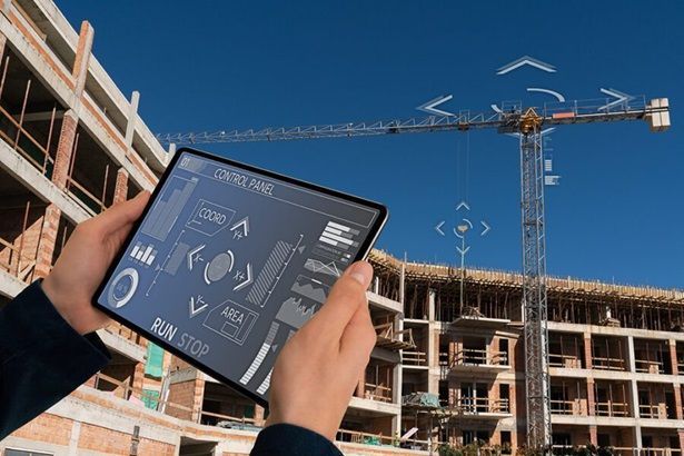
Autonomous flight is especially useful for repetitive mapping. Once an approved flight route has been established, the drone can collect information using consistent patterns. This can help project teams monitor excavation, earth movement, material placement, building progress, and site conditions. Engineers can combine drone-generated information with digital models to understand whether physical progress corresponds with planned designs.
The same approach can extend to infrastructure such as bridges, roads, towers, railways, and large public facilities. Rather than sending workers into every difficult or elevated location, organizations can use drones to perform initial visual assessments. Where a potential problem is identified, specialists can then conduct a more focused physical inspection.
Energy, Oil and Gas Applications
Energy infrastructure provides another important environment for autonomous drones. Power lines, solar farms, wind turbines, pipelines, refineries, and other energy assets can cover large geographic areas and may include locations that are difficult or dangerous for workers to reach.
Autonomous drones can conduct programmed inspection routes around selected assets and collect high-resolution imagery. Thermal sensors can add another layer of information by identifying unusual heat patterns in suitable applications. In renewable energy, aerial inspections can help locate damaged solar panels or examine large installations more efficiently.
For oil and gas companies, drones can assist with inspection and monitoring around pipelines, storage areas, and industrial facilities. Their ability to fly close to certain structures without requiring a worker to physically access every location can reduce exposure to some operational hazards. However, industrial drone missions still require appropriate planning, regulatory compliance, trained personnel, and safety procedures.
Mining and Remote Site Operations
Mining operations frequently involve enormous areas, complex terrain, stockpiles, excavation zones, and equipment that must be monitored regularly. Autonomous drones can support surveying and mapping by collecting aerial data over large sites without requiring survey teams to repeatedly cover the entire area on foot.
Three-dimensional mapping can help organizations estimate changes in terrain and material stockpiles. Repeated surveys can also provide a visual record of how a mine site develops over time. This can assist engineers and managers with planning, measurement, and operational monitoring.
Drones can also be valuable in remote environments where conventional inspection processes are expensive or time-consuming. Autonomous systems can be programmed to cover selected areas while operators monitor missions from safer locations.
Logistics and Drone Delivery
Drone delivery has received considerable attention because autonomous flight could potentially move selected goods without requiring a conventional road vehicle for every short-distance journey. Potential applications include medical supplies, small packages, urgent parts, and deliveries to locations where road access is difficult.
However, large-scale autonomous delivery requires more than a drone capable of flying from one point to another. Operators must address airspace coordination, aircraft reliability, communications, weather, package security, landing procedures, and emergency response. In the United States, the FAA’s current framework still places important requirements around commercial drone operations, while advanced BVLOS operations require additional regulatory pathways. The FAA is also developing UAS Traffic Management capabilities to support increasingly complex drone operations.
A mature delivery ecosystem would require many drones to operate safely in the same airspace. That makes automated traffic coordination increasingly important. The FAA describes UTM as an ecosystem designed to support functions including flight planning, authorization, surveillance, and conflict management, particularly for BVLOS operations.
| Industry | Autonomous Drone Application | Potential Operational Value |
|---|---|---|
| Agriculture | Crop monitoring, mapping, spraying | Faster field assessment and targeted operations |
| Construction | Site mapping and progress monitoring | Frequent, consistent project information |
| Energy | Asset and infrastructure inspection | Reduced need for difficult manual access |
| Mining | Surveying and stockpile monitoring | Efficient mapping of large areas |
| Logistics | Automated delivery missions | Faster movement of selected small payloads |
| Public Safety | Search, mapping, and situational awareness | Rapid aerial information during incidents |
Public Safety and Emergency Response
Emergency response is another field where autonomous drones can provide useful capabilities. During floods, fires, landslides, industrial accidents, and other emergencies, responders may need information from areas that are unsafe or difficult to reach. A drone can provide aerial imagery without immediately exposing personnel to the same conditions.
Autonomous capabilities can make these missions more effective when response teams need repeated observations. A drone can follow a predetermined route, monitor selected areas, or return to a designated point when its mission is complete. Thermal imaging may also help identify heat sources or people in certain environments, although weather, terrain, sensor limitations, and operating conditions can affect performance.
The Role of Regulation and Airspace Management
The expansion of autonomous drones depends heavily on regulation. As drones move from isolated flights toward routine commercial operations, regulators must address how unmanned aircraft can share airspace with other aircraft and how operators can maintain accountability.

One major area is Beyond Visual Line of Sight, or BVLOS, operations. The FAA’s current rules for small UAS generally require visual-line-of-sight operation, while waivers and other approvals can support certain advanced operations. In 2026, the FAA continues work around a broader regulatory framework for routine BVLOS operations.
This regulatory development matters because many of the most valuable autonomous applications involve distances beyond what a pilot can directly observe. Pipeline inspection, long-range surveying, agricultural monitoring, and delivery networks can all benefit from BVLOS capability. At the same time, safe integration requires reliable aircraft, communications, detection and avoidance capabilities, operational procedures, and traffic-management systems.
Challenges That Could Slow Adoption
Despite rapid technological progress, autonomous drones still face several practical challenges. Battery endurance remains an important limitation for many platforms, particularly when missions require long flight times or heavy payloads. Weather can also affect operations, especially in environments involving strong winds, rain, dust, extreme temperatures, or poor visibility.
Data security is another concern. Industrial drones can collect detailed images of facilities, infrastructure, property, and operational environments. Organizations therefore need appropriate cybersecurity practices for drone communications, stored data, cloud platforms, and connected systems.
Businesses must also consider the total cost of deployment. Purchasing a drone is only one expense. Organizations may need trained personnel, software subscriptions, maintenance, batteries, replacement components, regulatory approvals, insurance, data-processing systems, and operational procedures.
For organizations considering adoption, several factors deserve attention:
- Mission requirements and flight environment
- Sensor and payload requirements
- Battery endurance and communications reliability
- Regulatory and safety obligations
- Data security and integration with existing software
The most successful deployments are likely to focus on specific operational problems rather than adopting autonomous drones simply because the technology is available.
Conclusion
Autonomous drones are becoming increasingly relevant across industries because they combine aerial mobility with automation, sensing, and data analysis. Agriculture can use them for crop monitoring and precision operations, construction companies can use them for mapping and progress tracking, energy firms can apply them to infrastructure inspection, and mining organizations can use them to survey large and difficult environments. Logistics and emergency response also offer important opportunities as autonomous flight technology and airspace management systems mature. The broader transformation is not simply about replacing manual work with machines.